讓風景融入城市,讓生活走進風景
2023-01-10 00:55:28邊蘭春
世界建筑 2022年2期
關鍵詞:生態
邊蘭春
當前,我國城市發展方式已經從增量開發轉向存量更新,追求城市空間環境品質的不斷提升,建設創新、協調、綠色、開放、共享的城市,已經成為實現人居環境高質量發展的迫切要求。隨著城市的發展,納入到城市空間環境中的自然棲息地也在不斷流失,休憩空間嚴重不足。因此,宜人開放空間的塑造已經成為城市設計的核心內容之一,也是評價城市宜居性的重要考量標準。
水是城市的生命線,世界上很多城市都是因水而生、伴水而榮。河湖水體、綠色空間構成了城市藍綠生態空間網絡的主要部分,與之緊密相關的濱水空間也因承載了城市的自然生態、聯結起城市的休閑生活、孕育出城市的特色與活力,最終見證了城市的發展變遷,并被持續塑造成為城市的一道道靚麗風景。
長期以來,我們對城市中心地區繁榮活力的關注,遠遠超過了對城市邊緣地區生態和文化景觀價值的認識。城市邊緣地區是城市和鄉村的交界地帶,一方面,這一地區具有良好的生態環境本底,生態空間與城市空間融合的潛力巨大;另一方面,在城市擴展過程中,這一地區又往往因為城鄉用地混雜、管理相對薄弱,使生態空間與城市空間融合發展面臨很大挑戰;同時,另一個值得我們反思的問題:我們長期以來只把這些地區看作空間品質不佳的“城鄉結合部”,忽視了這些地區中開放空間與城市的生態關聯,忽視了社區發展中的生活互動,忽視了濱水營造中的景觀與活力。針對這樣的地區,如何通過“生態修復和城市修補”帶動生態資源的有機整合、交通體系的系統梳理、生活設施需求的細微體察,加強多元城市功能的高效組織,實現城市邊緣區的高質量發展,應該成為當下城市更新行動中亟待關注的重要議題之一。
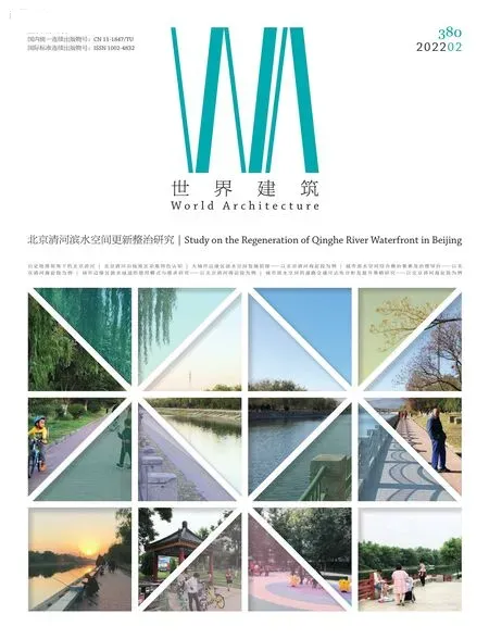
北京清河濱水空間也許就是未來城市設計與城市更新的一個典型案例。清河濱水綠廊是海淀北部高新科技發展區與南部城市密集區形成有機銜接的重要地區,更是西山風景區與東部城市建設區形成東西聯系的重要走廊。清河從清朝初年延續至今,伴隨著“三山五園”的建造和這一地區的演進發展而逐步發育成熟。清河是一條自然的河流,自西山向東匯入溫榆河;清河是一條文化的河流,串聯歷史的三山五園和現代城市創新聚集區中關村科技園、國際體育文化承載地奧林匹克森林公園;清河還是一條生活的河流,沿線地區已經從“城鄉結合部”逐漸演進為居民生活重要的休憩場所和交通走廊。歷史上的清河與北京自然水系的形成演變密切相關,現在的清河沿線,既有世界文化遺產頤和園,也有亟待更新改造的“城中村”,河流綠地、交通道路、居住社區、單位大院多種要素相互交織,錯綜復雜。探究清河以及因之興衰的聚落地理文化、功能認知和發展愿景,不僅可以更好地認知城市歷史、探索“三山五園”的遺產保護,還可以為這一地區的生態景觀修復和文化風景營造,奠定重要的基礎。
本期專輯收錄了清華大學建筑學院團隊的6篇研究論文,他們基于多年擔任清河沿線街鎮責任規劃師高校合伙人過程中的觀察和思考,從歷史、景觀、環境、交通、城市、社區、治理等多個維度展開對清河的研究。前3篇清河認知板塊,從歷史地理視角梳理了北京清河的演變(鐘舸等),厘清了對清河沿線地區城市功能特色的認知(黃鶴等),并從大城市邊緣區發展的視角探討了海淀清河段濱水空間發展的矛盾與問題(陳宇琳等)。后3篇濱水空間更新整治板塊,結合清河的空間現狀和社區結構提出了濱水空間綜合整治要素及治理導向(王英等),分析了城市邊緣區濱水綠道的使用模式與人群需求(陳宇琳等),并開展了面向濱水空間整治的道路交通可達性分析和提升策略研究(梁思思等)。本專輯的研究成果在清河濱水地區的城市設計實踐課題中還得以不斷深化,以期為清河濱水空間的更新整治提供多視角的解讀,同時也為我國大城市城鄉交界地帶濱水空間城市設計與城市更新中的精細化治理提供參考。
大約三年前,擔任該地區責任規劃師高校合伙人的清華大學團隊曾對清河綠廊規劃實施工作發出倡議,清河濱水地區環境品質的提升應以系統性的研究為基礎、以專題性的規劃為前提,依托多學科融合的研究實踐平臺,制定城市設計導則指引和行動指南,不斷探索參與式規劃的實施路徑和方法。為了發揮清河濱水綠廊地區獨特區位優勢,充分依托本地區生態景觀資源條件,面向社區生活的需求,制定整體框架、有序分段實施、注重持續提升,以人為本,實現“讓風景融入城市,讓生活走進風景”的美好愿景。□
(2019年10月17日清華大學高校責任規劃師團隊成員發起了《清河綠廊規劃倡議書》。2020年5月北京市規劃和自然資源委員會海淀分局組織開展了面向清河濱水地區空間環境的“清河行動”,并組織清華大學團隊與中國城市規劃設計研究院合作完成了《清河兩岸綜合整治提升規劃》。本專輯部分成果根據清華團隊負責的部分專題成果深化完成。在此向北京市規劃和自然資源委員會海淀分局和中國城市規劃設計研究院,以及支持參與這項工作的同仁一并致謝!)
Currently, the pursuit for innovative, harmonious, green, open and shared cities has become an urgent agenda for achieving high-quality development of human environment in China. After decades of development, the natural habitats are continuously disappearing in cities, and there is a serious shortage of open space. The pleasant open space has become one of the core elements of urban design and an important consideration in evaluating the liveability of cities.
Water is the lifeline of a city. Many cities in the world were born from water and thrived with water. Water bodies and green spaces are important elements of the city's ecological system. They bear the city's leisure life, nurture the characteristics and vitality of the city, and witness the development and changes of the city.
For a long time, we have paid little attention to the urban fringe, i.e., urban-rural areas. On the one hand, these areas have a good ecological background with great potential for integrating ecological spaces and urban spaces; on the other hand, in the process of urban expansion, these areas often face huge challenges in the integration because of disordered urban-rural land uses and relatively weak management. At the same time, another issue deserves our reflections – we have neglected the ecological connections, the social interactions, the landscape vitality of these urban-rural areas, and they have been in poor spatial quality for a long time. As a matter of fact, it is among the important issues in the urban regeneration actions that requires urgent attention regarding how to achieve high-quality development through ecological restoration, organic integration of ecological resources,systematic sorting of transportation system, investigation of facilities requirement, and high-efficient organisation of urban functions.
The waterfront space of Qinghe River is probably one of the most typical cases in urban design and urban regeneration in the future. Its landscape corridor connects the Haidian High-tech Development Zone in the north with the urban dense area in the south, as well as Xishan Scenic Area in the west with urban areas in the east. Qinghe River is a natural river, from Xishan Mountain to Wenyu River; it is a cultural river, bearing the history of royal gardens of Qing Dynasty and the Olympic Forest Park and Zhongguancun Tech-Zone; it is also a living river, evolving with important leisure places and traffic lines for the neighbourhood and communities. To explore the geographical culture, the functional perception and the vision of Qinghe River with its rise and fall will not only enable us to better understand the city's history, the conservation of royal gardens of Qing Dynasty, but also lay an important foundation for the ecological restoration and cultural landscape construction in this area.
Therefore, six research papers from SATU are featured in this issue, which are developed from various dimensions such as history, landscape, environment, transportation, city, community and governance based on the authors' observations and reflections during their years as responsible planners of streets and communities along the Qinghe River. It consists of two parts.The first part is about epistemology. Zhong, et al. summarises the geographical and historical evolution of Qinghe River area, and explores the relationship between the water and the urban development; Huang, et al. sorts out the functional evolutions of urban areas along the Qinghe River and proposes a development strategy integrating the Qinghe River with several important surrounding areas; Chen, et al. summarises the main problems and their causes faced by the development of waterfront spaces in the urban fringe of megacities, and puts forward the suggestions of waterfront space renewal to drive the development of urban fringes.
The second part is about practice. Wang, et al. concludes the space elements of comprehensive waterfront space management,and proposes improvement elements and management strategies combined with the characteristics of current waterfront spaces and structural features of the communities; Chen, et al. studies the use patterns and user needs of greenways through questionnaire surveys, and proposes several solutions to enrich the functions of the greenways; Liang, et al. proposes the relevant strategies to improve the traffic accessibility of waterfront space from road layout, pedestrian-oriented traffic, parking, and so on.The research demonstrated in this issue is still on-going work, which aims to provide multi-perspective interpretations for the renewal and improvement of the Qinghe River, and a reference for the urban design as well as refined management of waterfront spaces in the urban-rural areas of megacities in China.
About three years ago, when the team from Tsinghua University became the responsible planners, the plan of the landscape corridor of the Qinghe River was promoted to explore the approaches and methods of participatory planning to improve its environmental quality. Combined with its ecological landscape resources, and facing the needs of community with human-centred principles, blending landscape into the city and bringing life into the landscape is a good vision that has been partly realised in this area.
Our appreciation to Haidian Branch of Beijing Municipal Commission of Planning and Natural Resources, China Academy of Urban Planning and Design and many others, whose generous support makes this issue happened.□(Translated by PANG Lingbo)
猜你喜歡
保健醫苑(2021年7期)2021-08-13 08:48:02
學生天地(2020年36期)2020-06-09 03:12:30
小學科學(學生版)(2020年5期)2020-05-25 07:11:32
小學科學(學生版)(2020年4期)2020-05-21 07:30:46
小學科學(學生版)(2020年3期)2020-03-25 13:31:22
貴茶(2019年3期)2019-12-02 01:46:32
鄉村地理(2018年3期)2018-11-06 06:51:02
茶葉通訊(2017年2期)2017-07-18 11:38:40
河北城市研究(2015年4期)2015-08-23 11:53:06
浙江工商大學學報(2015年6期)2015-03-01 02:56:40