龍門山旅游區,成都,四川,中國
2014-02-18 09:41:24景觀設計清華大學建筑學院景觀學系北京清華同衡規劃設計研究院有限公司
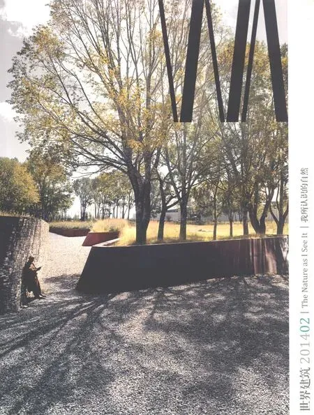
世界建筑 2014年2期
景觀設計:清華大學建筑學院景觀學系/北京清華同衡規劃設計研究院有限公司
Landscape Design: Department of Landscape Architecture at the School of Architecture, Tsinghua University/Beijing Tsinghua Tongheng Urban Planning and Design Institute Ltd.
龍門山旅游區,成都,四川,中國
Longmen Mountain Tourism Area, Chengdu, Sichuan, China, 2012
景觀設計:清華大學建筑學院景觀學系/北京清華同衡規劃設計研究院有限公司
Landscape Design: Department of Landscape Architecture at the School of Architecture, Tsinghua University/Beijing Tsinghua Tongheng Urban Planning and Design Institute Ltd.

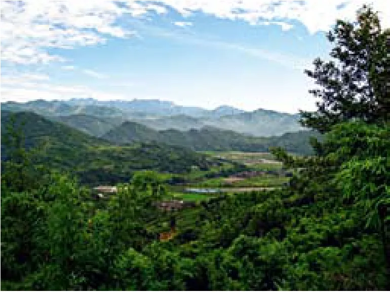
1 龍門山銀廠溝地震前景觀/Yinchanggou in Longmen mountain before earthquake
龍門山位于四川成都市西部,其推覆構造被稱為世界三大造山運動類型之一,同時這里也是中國大熊貓棲息地、生物多樣性寶庫。龍門山境內的青城山是中國道教起源地,同時這里也是漢、藏、羌多民族、多宗教文化交融區,溝通古印度、古西亞文化的南絲路起點。在龍門山4133km2的范圍內,包括了2處世界遺產、2處國家級自然保護區、4處國家重點風景名勝區、1處國家地質公園、4處國家森林公園、1處國家歷史文化名城、2處國家歷史文化名鎮、12處國家重點文物保護單位、1個國家非物質文化遺產。因此,龍門山堪稱具有自然、文化、科學、美學和經濟等多重復合價值的世界級遺產資源富集區,適合發展生態旅游、文化遺產旅游和休閑度假旅游。
2007年,成都市委、市政府提出借鑒歐洲阿爾卑斯山的發展經驗,建設 “龍門山國際山地旅游大區”。清華大學受托進行龍門山與阿爾卑斯山的比較研究,并贏得了龍門山旅游區策劃國際投標。2008年5月12日,龍門山所在區域遭受到地震重創,其中都江堰、彭州等地受災較為嚴重。項目組經過對震后龍門山的詳細補充調研,有針對性地進行了一系列專題研究,重點制定了龍門山旅游區公共安全與綜合防災減災體系,提出了龍門山旅游復興的思路,完成了龍門山旅游區概念規劃、總體規劃及功能區規劃,具體提出龍門山旅游發展總體定位為:具有世界品質的自然與文化遺產富集區,具有國家意義的城鄉統籌生態經濟示范區,中國領先、世界一流、多元復合、宜游宜居的國民休閑基地、國際山地型旅游目的地。
項目信息/Credits and Data
項目主持人/Principal in Charge:楊銳
主設計師/Chief Designers:劉海龍,鄧冰
合作單位/Collaboration:北京清華城市規劃設計研究院風景旅游數字技術研究所,瑞士庫爾應用科技大學旅游與休閑研究所,成都規劃設計研究院
項目面積/Area:4133km2
項目時間/Project Period:2007.8-2011.7
攝影/Photos: 劉海龍(Fig 1,6,11,12,20-22),成都市林業和園林管理局(Fig 3,7-9),鄧冰(Fig 10),薛飛(Fig 23)
Longmen Mountain is west of Chengdu in Sichuan Province. Its geology and biodiversity are valued across the world. The area is ethnically and religiously mixed. Qingcheng Mountain is the birth place of Taoism and also the starting point of the southern Silk Road. The4133 km2area is home to two world heritage sites, two National Nature Reserves, four National Parks, one National Geological Park, four National Forestry Parks, one National Historical City, two National Historical Towns, twelve National Cultural Heritage sites and one National Intangible Heritage area. Longmen Mountain is a rich area with important natural and cultural heritage resources.
In 2007, the Chengdu municipal government instigated the Longmen Mountain tourism plan and organized an international competition for the development of the area. Tsinghua University made a comparison study between Longmen Mountain and the Alps and was awarded tourism plan project. But in 2008 this area suffered the catastrophic effects of the 5.12 Wen Chuan earthquake and suffered serious losses in areas such as Dujiangyan and Pengzhou. The Tsinghua team started supplemental investigations immediately after the earthquake and launched a series of special research projects relating to the public security system and comprehensive disaster prevention scenarios. The Tsinghua team subsequently completed the concept plan, master plan and Special Functional Area plan for the area. The overall objectives of the Longmen tourism plan are to develop a natural and cultural heritage accumulation area of world quality, create an ecological economic demonstration area and ecological barrier for Chengdu and to become the leading recreational and tourism area of China and a world-class mountain destination.

3 龍門山鞍子河保護區八卦頂/Baguading in Anzi-river reservation area (3628m)
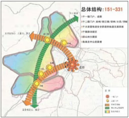
2 龍門山旅游大區策劃總體結構圖/Structure planning for Longmen mountain tourism area
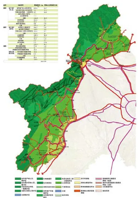
4 龍門山旅游區總體規劃/Zoning plan of subdivisions
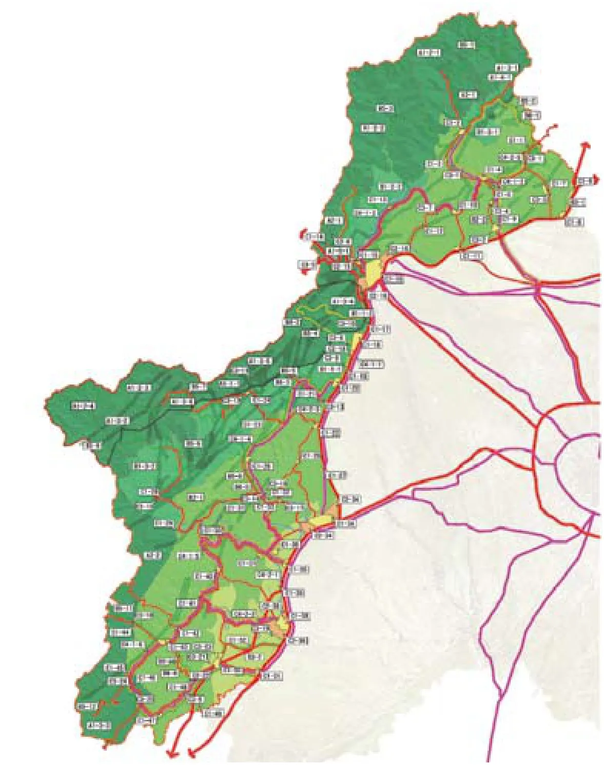
5 龍門山旅游區總體規劃索引圖/Zoning plan index
成都市龍門山旅游區規劃系列項目
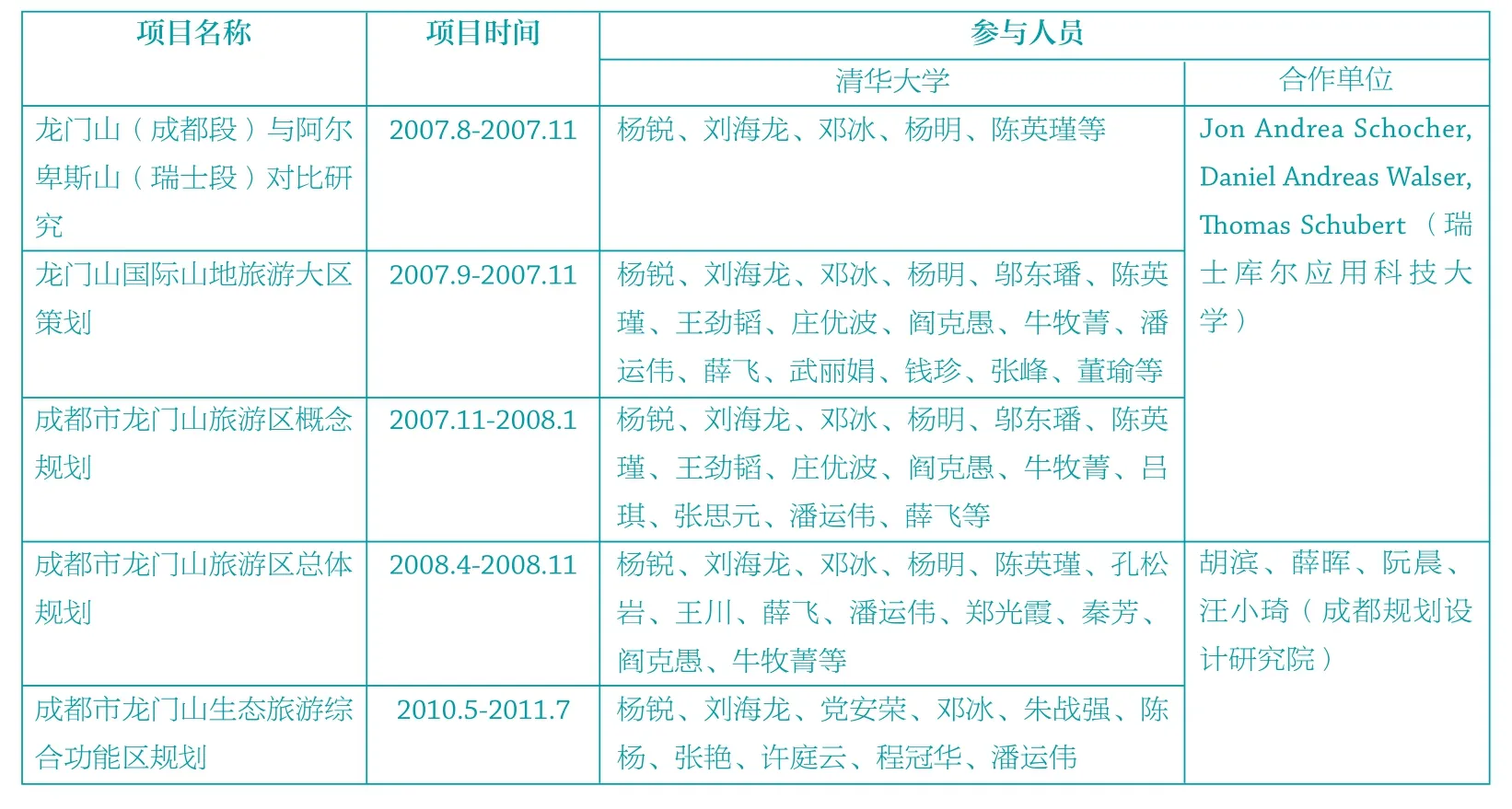
6 龍門山邛崍段的古塔/Historic tower

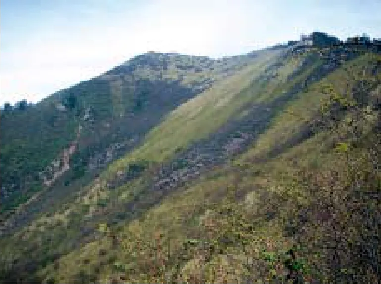
7 龍門山鞍子河保護區大尖峰/Dajianfeng in Anzi-river reservation area (3651m)
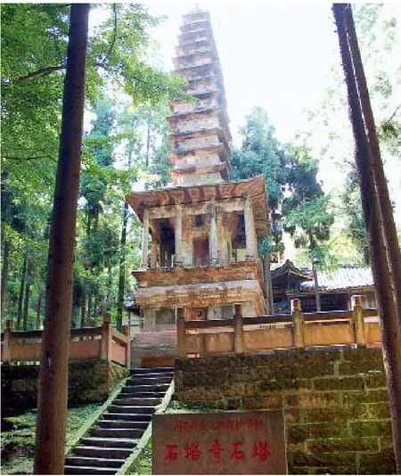
8 龍門山龍溪—虹口高山草甸/ Meadow in Longxi-hongkou area (3100m)
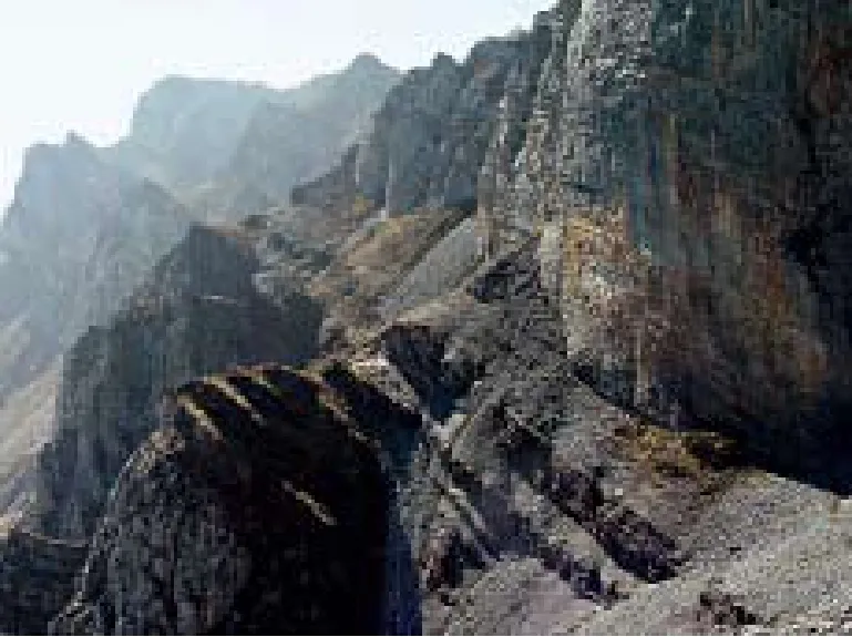
9 龍門山黑水河保護區高峰/Peak in Heishui-river reservation area
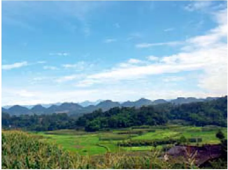
10 龍門山邛崍段的南寶山/Baonan mountain in Qionglai
11 龍門山邛崍段的山脈與田園風光/Mountain and field in Qionglai

12 青城山/Qingcheng mountain
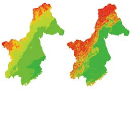
13 高程與坡度分析/Elevation and gradient analysis
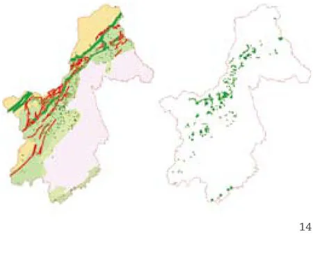

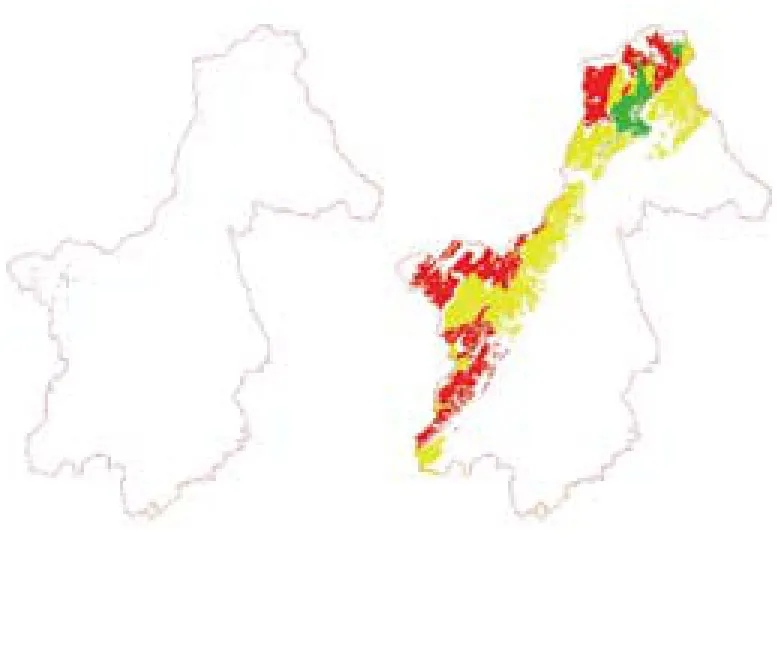
14.15 地震災害分析/Earthquake disaster analysis

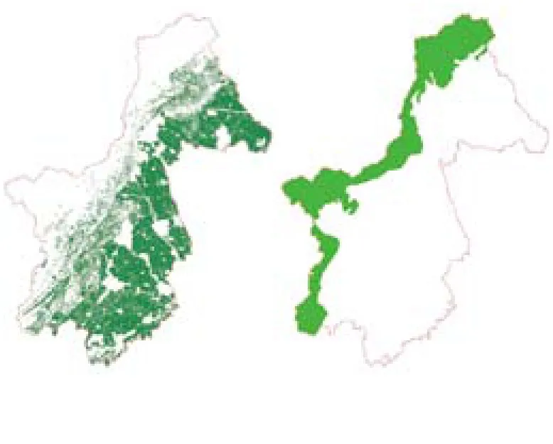
16 水文與植被分析/water and vegetation analysis
17 珍稀動物生境分析/Rare animal analysis
18 基本農田與保護區分析/Agriculture and reservation area
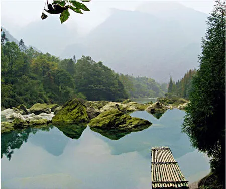
19 龍門山銀廠溝地震前景觀/Yinchanggou in Longmen Mountain before earthquake
20 地震發生時的龍門山銀廠溝/Yinchanggou in the earthquake (2008-05-12,14:46)
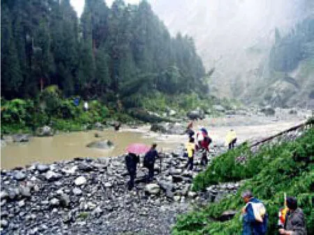
21 地震后下山/After earthquake (2008-05-13,9:33)
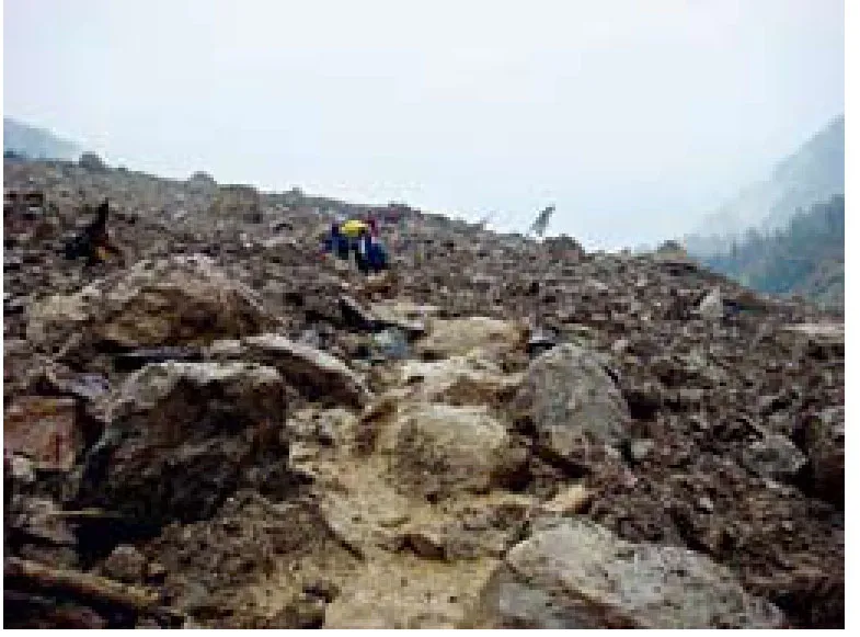
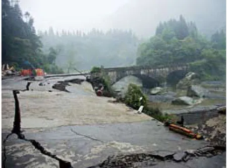
22 地震后的塌方山體/Landslide after earthquake (2008-05-13,10:40)

23 龍門山邛崍段的南寶山/Baonan mountain in Qionglai
評論
張路峰:一個綜合的山地風景區旅游規劃項目,運用GIS技術,梳理、整合了當地豐富的自然資源和人文資源,確定了以旅游開發和生態保護為主線的宏觀思路。項目進行過程中遭遇“5·12”地震,為此補充了公共安全、生態恢復等針對性內容,為該地區災后重建工作的迅速開展提供了及時有力的指導。規劃效果的呈現,還有待下一步對規劃的執行和一系列相關項目的操作。
胡一可:景觀的使命。規劃力圖減弱“5·12”地震對于旅游的消極影響,彌補不可再生旅游資源破壞帶來的損失,重建旅游產品的空間格局,同時建立了公共安全與綜合防災減災體系。規劃在完成一項使命,超越了一般意義上的空間布局,在戰略和策略層面進行了深入研究,幫助當地政府重塑信心、重拾機遇,讓龍門山乃至四川旅游走上復興之路。
Comments
ZHANG Lufeng: This is a comprehensive tourism master plan for a scenic mountain region. Using GIS technology, the plan analyzed ways to consolidate the area's rich natural and cultural resources and identified tourism development and ecological preservation as primary strategies. In 2008, in the midst of the planning process, the site suffered the 5.12 earthquake. In response to the earthquake, the designers added a series of special sections-regarding public security systems and ecological restoration-to the plan. These additions provided strong and timely guidance for swift post-disaster reconstruction in this region. The ultimate effectiveness of the plan still relies on the completion of the next step, the implementation and execution of a series of related projects.
HU Yike: Landscape's mission. This planning project aims to reduce the negative impact of the 5.12 earthquake on tourism in the Longmen area. It tries to address the loss of non-renewable resources that resulted from that disaster, to rebuild the spatial system of the tourism industry and to establish comprehensive public safety, disaster prevention and mitigation systems. The planning has a mission and goes way beyond creating a workable spatial layout. The in-depth studies, strategies and tactics produced focus on rebuilding the local government's confidence and generating opportunities for tourism that will revitalize Longmen Mountain and Sichuan.
猜你喜歡
現代裝飾(2021年6期)2021-12-31 05:27:54
小學科學(學生版)(2020年12期)2021-01-08 09:28:10
少年漫畫(藝術創想)(2020年12期)2020-06-09 05:50:08
領導決策信息(2018年50期)2018-02-22 06:17:16
商周刊(2017年5期)2017-08-22 03:35:26
今古傳奇·故事版(2016年24期)2017-02-07 04:29:04
中國衛生(2016年2期)2016-11-12 13:22:16
中國工程咨詢(2016年4期)2016-02-14 07:28:28
數學大王·低年級(2014年7期)2014-08-11 16:36:44
中國攝影家(2014年6期)2014-04-29 14:54:47